Posted on

Air law – definitions of Canadian airspace

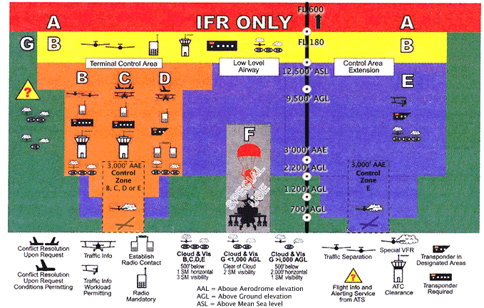
Canadian Airspace. Image from IVAO.com

Following up on the previous article on air law, let’s review some details about Canadian airspace.

Air law is such a big topic and is very hard to cover in it’s entirety, so if you want more detail or more material refer to From the Ground Up and Canadian Aviation Regulations,  the Canadian Aeronatical Information Manual.

Canadian Domestic Airspace is divided into seven classification, each identified by a single letter.  The rules governing each airspace depend on it’s classification and not by which name the airspace is commonly known.  Control l or terminal areas can be classified B, C, D or E but weather minimums for flying are still related to the common name of the controlled or uncontrolled airspace.

The classification, as you may remember from ground school, looks sort of like an upside down layer cake, where the smallest classifications are nearer the ground and larger zones extend upward.

Class A 

This is all controlled high level airspace, only IFR flight is permitted. It spans from FL180 to FL600, inclusive.  ATC (air traffic control) is provided to all aircraft, and require clearance to enter.

Tower at YBW. Contol zones can be class B, C, D or E.

Class B

In class B airspace, IFR and VFR traffic is allowed. ATC is provided. It includes all controlled low-level airspace between 12,500 and up to, but not including 18,000. VFR traffic must file a flight plan and request a route to enter.  A pressure altimeter is required (has to have been certified within 24 months) and a transponder with mode C capability.

Class C

IFR and VFR permitted. VFR must be cleared by ATC to enter. Terminal control areas and associated control zones may be classified Class C when the appropriate ATC unit is not in operation.  A 2 way radio and transponder with mode C capability is required.  In case of a communications failure, squawk 7600.  Otherwise,  VFR traffic must use 1200 on transponder.

Class D

Both IFR and VFR traffic are permitted, and VFR must establish radio communications with ATC.  ATC separation is only provided to IFR traffic.  Terminal control zones can be classified Class D, and if there is no ATC they will revert to Class E.

 Class E

This class of airspace exists when none of the requirements for neither A, B, C, D are met. Both IFR and VFR are permitted but again, ATC separation is only provided to IFR traffic. There are no special requirements for VFR traffic.  Low level airways, control area extensions, transition zones and control zones without an operating tower may fall into this category.

Class F

Forbidden or advisory airspace.

Class G

Does not fit into any of the other airspace categories, and ATC has neither the responsability nor obligation to manage traffic. This is uncontrolled airspace.  Low level air routes and aerodrome traffic zones fall into this category.

It’s easy to forget these classifications.  A useful mnemonic to remember these types of airspace and what is associated with each will help you remember!

A = Airliners. IFR only. Between 18,000 and 60,000 feet.

B= IFR.  Between 12,500 and 18,000

C = Clearance required to enter

D = Dialogue is required. Do not enter before talking to a controller.

EEasy for VFR, Everyone gets home from this class of airspace, no need to talk to controllers.

F = Forbidden, or Fancy  – special use airspace.

G = General uncontrolled airspace.

And of course, the U.S. has their own unique system of classification.  Information on the U.S. system can be found in From the Ground Up.
Posted on

What is VFR?

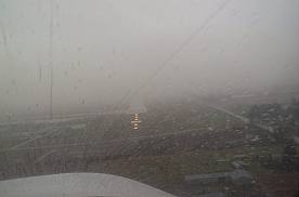
IFR Flying Conditions. Image Courtesy of Langley Flying School.

It’s springtime, and out here in Alberta the weather is all over the place. From clear, sunny, calm days arrive strong wings, snow, sleet, rain, low ceilings and all sorts of weather, signifying change of seasons. Yesterday for example we did not have VFR weather here.  In fact, with a visibility of 1/2 SM, vertical visibility of 500 feet and snow at CYBW we have LIFR, or low instrument flight rules conditions – this means ceilings and visibility conditions below IFR minimums. Ceiling is below 500 feet and visibility is less than 1 SM.

There are two kinds of flight rules, visual flight rules and instrument flight rules.  VFR stands for visual flight rules and means the pilot flies the aircraft with visual reference to the ground, using landmarks, roads, avoid aircraft in the vicinity, avoiding terrain and obstacles.  The pilot must know where they are at all times and maintain visual contact with the ground at all times.

Weather minimums have been established to allow the pilot to fly VFR.  These are listed in the table below:

VFR Weather minimum. Image from the AIM and Langley Flying School.

As long as these minimums are observed, the pilot can fly VFR.  Remember that some types of airspace do not allow VFR traffic, or VFR traffic must seek permission in order to enter certain kinds of airspace.

Also applying to VFR traffic are altitude rules. VFR traffic flying at 3000 feet AGL or higher must follow specified rules about altitude depending on direction flown. Cruise altitude is based on magnetic track. The altitudes are:

For headings: 000 degrees – 179 degrees = ODD thousand + 500 feet

For headings: 180 degrees – 359 degrees = EVEN thousand + 500 feet

VFR traffic is not allowed to fly over cities (built up areas) lower than 1000 AGL, and should not descend below 500 feet AGL during flight – of course this does not apply to special flights (police, ambulance) nor during take off or landing phases of flight. This explains why the traffic helicopter always seems to buzz my house!

VFR traffic can use instruments to operate, but are not allowed to rely on them unless they have an IFR rating, and are flying IFR.

Pilots flying VFR are allowed to start a flight that is initially VFR but changing to instrument meteorological conditions (IMC), and where visual flying will not be encountered anymore.  The best thing to do in this situation as a VFR pilot is to either fly straight and level until the conditions improve, or complete a 180 degree turn where you came from to return to visual conditions. Also, if you are near a control zone, you can request SVFR – special VFR.  The aerodrome must have at least 1 mile visibilty and you must remain clear of cloud.

If you are not near a control zone and encounter these conditions, you are forced to fly IFR.  The best solution is to avoid IMC if possible unless you are IFR rated.

Another solution is to fly VFR “over the top” or OTT.   This is a special rating that private pilot license holders can get to fly over cloud cover, maintain visual contact with other airplanes flying IFR while giving VFR pilots greater flexibility. This rating can be added to your PPL with 15 hours of  flight training.

Posted on

Convert an FAA certificate to a Canadian private pilot license

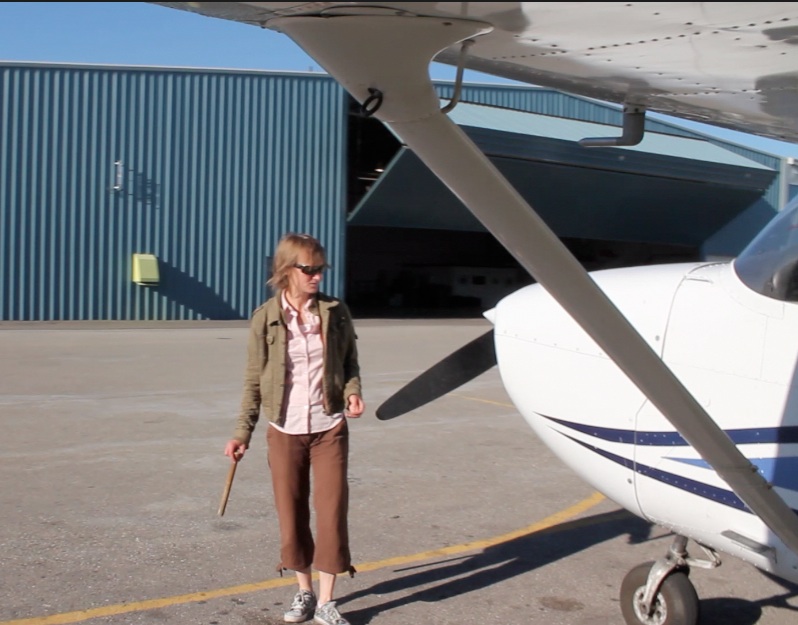
Pre flight check on a Cesna 172

A little while ago someone asked us how to convert an FAA certificate to a Canadian Private pilot license.

Applicants are required to write a conversion examination consisting of several topics that have mainly to do with Canadian air law. Regulations should be reviewed as they apply to airplanes in VFR operations.  These are found in the table below.

CARS – are Canadian Aviation Regulations and found on Transport Canada’s website. The AIM is the Aeronautical information Manual and may also be found on the TC website, and you can download a a pdf copy of the publication.

Below are the specific subjects that need to be studied for the exam.

CARs Part I, Subpart 1 GENERAL PROVISIONS
101.01 – Interpretation (definitions as needed)
CARs Part IV, Subpart 1 FLIGHT CREW PERMITS, LICENCES AND RATINGS
401.05 – Recency Requirements
401.26 – Private Pilot Licence, Aeroplanes – Privileges
CARs Part IV, Subpart 4 MEDICAL REQUIREMENTS
404.04 – Issuance, Renewal, Validity Period and Extension of a Medical Certificate
CARs Part VI, Subpart 1 AIRSPACE
Division I – Airspace Structure, Classification and Use
Division II – Aircraft Operating Restrictions and Hazards to Aviation Safety
CARs Part VI, Subpart 2 OPERATING AND FLIGHT RULES
Division I – General
Division II – Operational and Emergency Equipment requirements
Division III – Flight Preparation, Flight Plans and Flight Itineraries
Division IV – Pre-Flight and Fuel Requirements
Division V – Operations at or in the Vicinity of an Aerodrome
Division VI – Visual Flight Rules
Division VIII – Radiocommunications
Division IX – Emergency Communications and Security
CARs Part VI, Subpart 5 AIRCRAFT REQUIREMENTS
Division I – Aircraft Requirements – General
Division II – Aircraft Equipment Requirements
TC AIM – GEN GENERAL
1.0  – General Information
3.0 – Transportation Safety Board of Canada
TC AIM – AGA AERODROMES
7.19 – Aerodrome Lightning – Aircraft Radio Control of Aerodrome Lightning (ARCAL)
TC AIM – COM COMMUNICATIONS
5.15 – Radio Communications – Phone Use During Radio Communication Failure
TC AIM – RAC RULES OF THE AIR AND AIR TRAFFIC SERVICES
2.0  – Airspace – Requirements and Procedures
3.6 – Flight Planning – Flight Plans and Flight Itineraries (Opening)
3.12 – Closing
4.0 – Airport Operations
5.0 – VFR En Route Procedures
TC AIM – SAR SEARCH AND RESCUE
3.9 – Emergency Locator Transmitter – Schedule of Requirements
TC AIM – MAP AERONAUTICAL CHARTS AND PUBLICATIONS
2.0  – Aeronautical Information – VFR
6.0 – Aeronautical Information Circulars – General
TC AIM – LRA LICENSING, REGISTRATION AND AIRWORTHINESS
3.9 – Pilot Licensing – Recency Requirements
TC AIM – AIR AIRMANSHIP
1.6 – General Information – Canadian Runway Friction Index
2.12 – Flight Operations – Flight Operations in Winter
Posted on 1 Comment

A student of weather

A student of weather.

Being a pilot means being a student of weather – all the time.

Weather is so fickle in Alberta that you quickly learn how much flying depends on it.

I did my ground school for my PPL a few years ago at Centennial Flight School in Edmonton City Centre airport.  After years of putting it off, I’m finally getting myself in gear to study for my ground school exam.  It’s harder once you’re done ground school and have had a long break from the theory in the lectures. And one of the most challenging topics is weather.  Things like instruments, aerodynamics, aircraft engines, navigation and air law, are more practicable, and used more often on a day to day basis. Many students struggle with weather theory the most.

Because I backcountry ski and climb, I feel like I already have a very close relationship with weather, specifically mountain weather. But in no other discipline will you have a more direct relationship with weather that you do when you fly.  It determines whether you can actually go up or not, and your safety while up in the air.  There is no ‘waiting out’ the weather once you make that decision to go up.

Weather determines whether or not we can fly VFR (with visual reference to the ground).   Fog will ground many of us.  Stay far away from thunderstorms, avoid icing and turbulence.  Mountain waves can be deadly. We need to know how wind shear affects aircraft performance.  Each airplane has a design limit for maximum cross wind – we need to be aware of these limits.

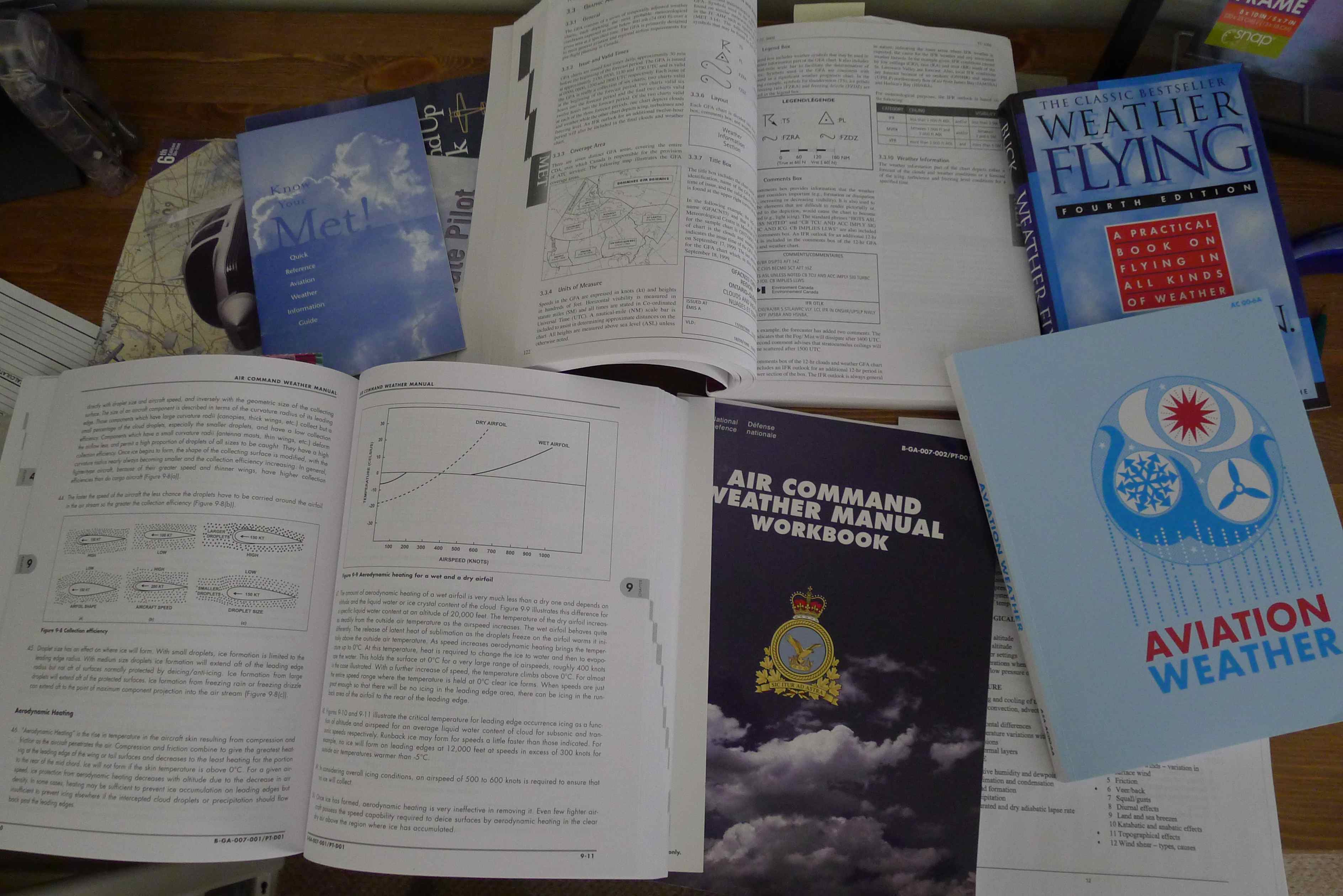
Air Command Weather Manual - by National Defense Canada
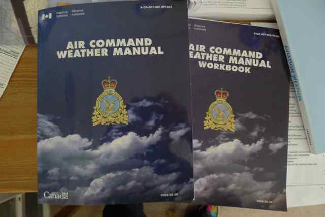
Air Command Weather Manual – by National Defense Canada

What are some of the best study aids for weather?

I want to share one of the most useful resources for studying weather I’ve recently discovered: the Air Command Manual which is published by National Defense Canada.  My instructor suggested I purchase it and I am really happy I did.  I find it very comprehensive and easy to follow: important sections are broken down into a series of lectures that can be easily referenced and reviewed.  In addition, an accompanying workbook can also be purchased in which you can test your knowledge in each specific area.  I find it a really great way to review and re-learn the specific weather topics. I have been using it every day since I got it, in preparation for the weather portion of my PPL written exam.


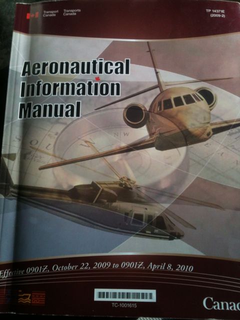
Aeronautical Information Manual (AIM), published by Transport Canada.

Transport Canada’s Aeronatical Information Manual (AIM) is also a very good source of weather information. It presents all of the weather products for aviation, in detail.  It tells us when the reports are published and for what areas, how long they are valid for and what all the various symbols and abbreviations are on the charts.  It is an invaluable study tool. This book is updated regularly and in fact, says on the cover when it is valid. For example, my old AIM book which is pictured was valid from October 22, 2009 to April 8, 2010. This book comes with your ground school kit when you sign up for ground school.

And of course,  the flying “bible”for Canadian pilots, “From the Ground Up” has a very good and detailed weather section, giving us the theory and application.  This also comes standard with your ground school kit.

These books can be referenced again and again, even once you are done your exams and have your license.  Certain areas, particularly when it comes to weather theory are easy to forget and these books exist so they can be easily referenced.  These books should be used regularly in your aviation career.

But of course, the best teacher is actually practical experience. Having all these resources is great but getting out and flying in all sorts of weather conditions, those we can manage of course, is indispensable.

Being a pilot means being a lifetime student of weather.

Review your weather reports!

Many different flight instruction books are available on Amazon

Posted on

Airport weather minimums

Since the weather has been so bad for the month of October in the Calgary area, we have been seeing a lot of IFR weather – weather that I, as a private pilot can’t go flying in.  What defines IFR conditions?  I thought it would be useful to post the IFR outlook chart as published by The Aeronautical Information Manual (AIM).

This table shows the airport weather minimums required for operation – takeoff and landing.

There is also SVFR – special VFR that the VFR pilot can request when minimums are not met. SVFR requires that the pilot has at least 1 mile visibility, stays clear of cloud and the aerodrome has 1 mile horizontal visibility.

Category Ceiling Visibility
IFR Less than 1000 feet AGL and/or less than 3 SM
MVFR between 1000 feet and 3000 feet AGL and/or between 3 and 5 SM
VFR more than 3000 feet AGL and more than 5 SM